Over the past year our ideas have developed. We shifted our emphasis from man-made disruptions between land and sea to the consequences of these disruptions in the intertidal zone. To us the intertidal zone has a certain magic; the changing light, the effect of the wind on the surface of the sea, the dramatic changes in the sky and the patterns and colours.
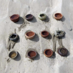
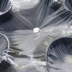
The work presented at the Bewaerschole was a series of visual experiments using found materials. We wanted to show how water, salt and sediment couldn’t be contained. We created a geometric structure from glass squares to act as a metaphor for the large-scale engineering works in the landscape. Then we poured water taken from the intertidal zone on the glass and allowed it to evaporate. The result showed not only the patterns of the sediment but also how the salt travelled around the room with no bounds.
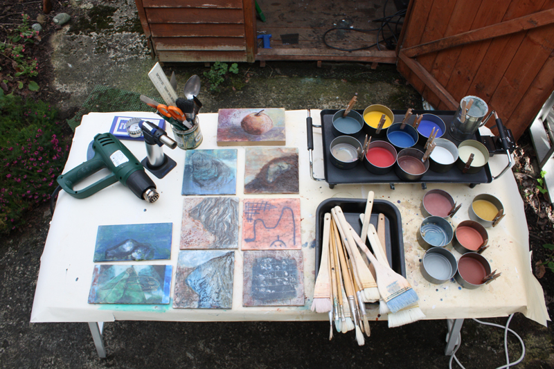
In June we started experimenting with new materials, we tried to combine the physical fieldwork and the visual experiments of the Bewaerschole. In order to represent both the depth and flow and the fragility and change of the area we used encaustic medium (beeswax and damar resin), which is build up in layers and manipulated with heat.
Concept for progressing the work 2015
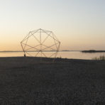
This year we are going to continue to focus on the effects of flood prevention measures in the delta. There should be a natural watery element that escapes the discipline of geometry lying between land and sea. We should be able to place this element in its own sphere, subject to states and cycles of hydrology, making the coastline not a geographic transition from land to sea but a dynamic chasm where twice a day water rushes in and out with the tide. This element has been put under pressure and squeezed between the Oosterschelde estuary and the island Schouwen-Duiveland.
In a magazine published by Harvard University we found an article about the Sundarbans delta in India. It explains well the complexities of delta regions and tries to give a new perspective on it:
‘It is the product of a cultivated imagination that clears the ground of vegetation and all other sources of ambiguity to articulate a river that flows from land to sea, a flow best captured by the map with a view from above. This divided ground is a world apart from a river that flows across the earth as a geographic entity before it enters not a sea but the sphere of ocean, turning into a field of vegetation, thickened air, liquid mud, salty water, and everything else that the watery element can infiltrate. It inspires an eye that turns away from the plan view of the earth to a temporal and material appreciation of the ocean. Embanking against the sea does not occur to the imagination here; instead, the imagination is drawn toward anchoring in the complexities of the watery element.
This could be the start of a new design trajectory that does not read the coast as a line between land and sea that needs defending, but a place where incommensurable worlds of earth and ocean allow for infrastructure and practices that accommodate both on their own terms.’ [1]
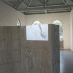
With these ideas in mind we have come up with the following conclusion to our research. We hope to present three elements for our exhibition in September: one a sculptural piece, representing the lack of exchange between land and sea, using sediment and salt; the second a wall piece in encaustic showing the play between the geometry imposed on the land and a more fluid gradation between land and sea; the third an archive of our visual experiments (drawings, photos, maps and models).
[1] Anuradha Mathur and Dilip da Cunha – Sundarbans: A space of Imagination / Wet Matter No. 39 – F / W 2014